

Our comprehensive aerial services are designed to empower your construction project at every stage. With a focus on safety, accuracy, and efficiency, we provide the critical data needed for informed decision-making. By utilizing our wide rang of construction progression services, you can manage project resources more effectively and meet project timelines confidently.
Aerial Construction Services
Empowering Construction Projects with Aerial Services

Achieve Construction Excellence and Competitive Advantage
As a leading aerial service provider, we combine years of industry experience with a team of FAA-certified UAS pilots. Our commitment to excellence and innovation allows us to tailor solutions that meet the unique needs of your project, ensuring precision, efficiency, and success in construction management.
Realized Critical Data From Our Key Deliverables
Inventory Verification -Aerial imaging and 3D mapping for accurate material counts.
Quality Assessment -Thermal imaging for defect detection.
- High-resolution visuals for material inspections.
Documentation Review - Automated data capture and integration with project management software.
Waste Management - Analysis of waste volume and continuous material usage monitoring.
Supplier Evaluation - Delivery verification and tracking supplier performance.
Financial Implications - Cost analysis of material usage vs. orders. - Budget tracking via aerial surveys.
Compliance - Visual inspections and real-time regulatory monitoring.
By incorporating drones, contractors can enhance reporting accuracy and decision-making, leading to safer and more efficient projects.
Tailored Solutions from Experienced Professionals
Partnering with us gives you a competitive edge in the construction industry by reducing costs, enhancing safety protocols, and optimizing timelines. Our dedication to exceeding expectations ensures timely and accurate data for your project, helping you achieve construction excellence and reach new heights in collaboration.
What you’ll get
-
Cost-Efficiency
While the initial investment in drone services may seem significant, the long-term cost savings are substantial. Our drone solutions accelerate project timelines, reduce labor costs compared to traditional surveying and inspections, and minimize risks of errors or rework. The impressive return on investment (ROI) for utilizing drones in construction is evident through enhanced efficiency, improved safety, and better overall project outcomes.
-
Improved Safety
Safety is a top priority in the construction industry. Our drone services minimize the need for manual inspections in hazardous areas, such as heights or dangerous zones. Drones efficiently assess the structural integrity of buildings, bridges, and infrastructure, reducing risks to human inspectors. This enhances construction site safety protocols and ensures more accurate, timely assessments without endangering workers.
-
Enhanced Communication
Enhance communications among construction project stakeholders. High-quality aerial images and videos provide a clear, shared view of the project's status, aligning architects, engineers, contractors, and clients. This visual data ensures smoother collaboration, improving project transparency and helping all parties stay on the same page regarding goals and progress.
-
Compliance and Accountability
Ensure that construction projects have the necessary aerial data to meet regulatory requirements. Drones help demonstrate compliance with safety standards, zoning regulations, and environmental laws through detailed, accurate visuals. This transparency keeps project managers and stakeholders accountable throughout the construction process, streamlining the path to regulatory approval and ensuring adherence to all relevant laws.
-
Scalability and Versatility
Whether it’s a small residential project or a large-scale commercial development, our drone services adapt to projects of any size. We capture precise data from various angles and altitudes, making our services a versatile solution for diverse construction needs. From detailed aerial views to accurate measurements, our drones provide valuable insights that streamline project planning and execution.
-
Progress Tracking and Reporting
Provide regular aerial imagery and video capture of your construction site. These visuals are essential for creating detailed progress reports, allowing project managers and stakeholders to, Monitor developments, Track timelines, Ensure projects stay on schedule. This level of transparency fosters effective communication and enhances risk management throughout the project lifecycle.

Site Inspections
Aerial inspections can identify quality issues early, allowing for prompt corrective action. This helps ensure that sites meets the desired standards.
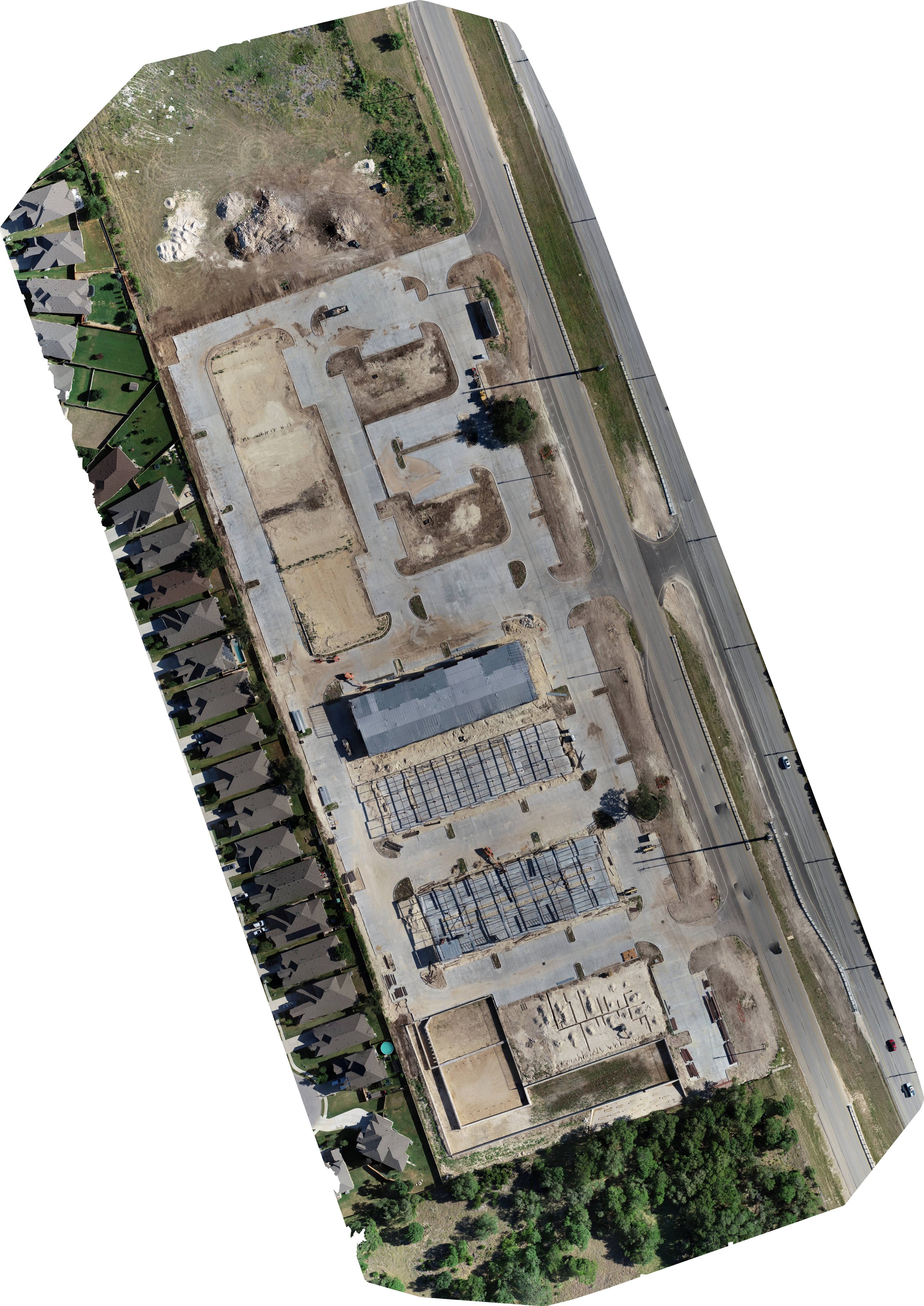
Construction Site Drone Progression Project
Site PLANNING/Progress
Aerial imagery provides a comprehensive view of the construction site, aiding in site planning and logistics. Project managers can use this data to optimize the placement of equipment, materials, and personnel. Additionally, our drone services create a permanent visual record. Ensuring that all key elements of your projects are documented for reference and compliance.
Frequently asked questions
-
We have extensive experience working with construction companies and have completed numerous projects ranging from site mapping, modeling to progress monitoring.
-
Yes, all our drone operators hold FAA Part 107 certifications and our company is fully insured, including liability coverage.
-
We use state-of-the-art drones equipped with high-resolution cameras and, if needed, specialized sensors for various data capture needs.
-
Certainly, we can share case studies and references from previous construction projects that demonstrate our capabilities.
-
We can provide high-resolution images, orthomosaic maps, 3D models, topographic models, thermal imaging, and more, depending on project requirements.
-
We typically require a lead time of 3 days to ensure we can meet your project's specific requirements.
Ready to transform your construction site Data?
If you want to save time, reduce risk, tract materials and keep your projects on schedule.
Contact us today!